Showing posts with label Aberdeen. Show all posts

Tuesday, 9 August 2011

Ghosts of Castle Street #1: The Lost Street

As promised, a spooky tale to rival Downie's ghost!

If you had stood at the junction of Marischal and Castle Streets in the 1530s, you would not have been able to proceed to the harbour, as Marischal Street did not exist!  George Keith, 5th Earl Marischal and founder of Marischal College was busy sizing up the plot next to Pitfodels' Lodging for his new townhouse.  The Lairds of Pitfodels were the Menzies family, a very prominent and influential clan from the 15th century up to the Jacobite Rebellion and after.  One Gilbert Menzies is buried in the Snow Kirkyard just off College Bounds in Old Aberdeen which was disparagingly known as the Papists' Burial Ground after the Reformation.  The Menzies were Roman Catholic, and their old home at Blairs near Maryculter became a Catholic seminary which lasted until the 1980s.

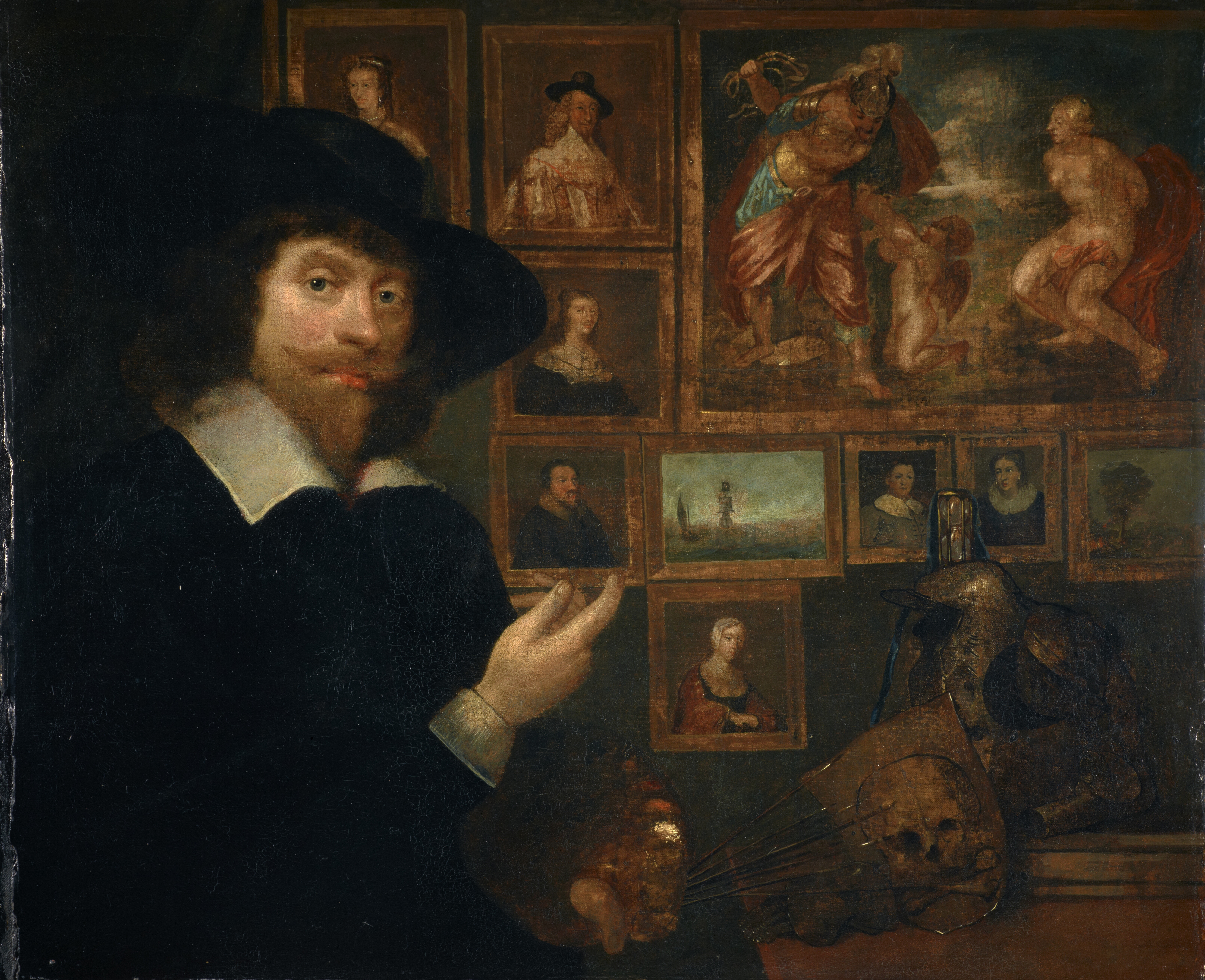
Pitfodels Lodging in Castle Street was one of the earliest stone dwellinghouses in the Aberdeen of the Middle Ages.  According to Edward Meldrum (Aberdeen trained architect, historian and all-round quite interesting fellow), it was William Jameson, master mason, the granddad of our favourite portrait painter, George Jameson - who rescued the Spa Well in an earlier post - who built a stone townhouse for the Menzies in 1535 to replace a wooden one burned down five years' previously.  It had a long back garden, like many of its neighbouring houses, stretching down to the quay.  Later, the Jacobite John Menzies had a back 'hoose' extension added in 1740.  The 'court' which was accessed from the archway or close on Castle Street was called Victoria Court by the 1860s and still exists today.

All trace of the Menzies' townhouse has gone today and was replaced in 1801 by the Union Bank.  Remodelled again in the twentieth century after almost two hundred years as a bank, it is now the Court Annexe, formed to relieve some of the pressure on the Sheriff Court across the road.  However, those who worked in the bank soon discovered that the former occupants may not have entirely quit the building.

Reading Graeme Milne's fascinating collection of ghostly experiences, The Haunted North, I soon discovered that in the depths of the bank - where Pitfodels Lodging had stood - and another mysterious building Milne mentions was a bank also, contained a lost street which generated some disturbing experiences!

Milne's interviewees described a 'road' in the basement of the bank, an old stone walkway of cassies which appeared to lead downwards to the quay.  Beside this 'road' were several 'cells' with big wooden doors inset with barred windows.  Milne himself had a fearful experience having found another part of the 'road' under a building off Victoria Court - I think this was the 1740 'back hoose' built by John Adam, though Milne doesn't say that.  I quote here from The Haunted North, Milne is talking about being in the basement where this road was found along with a council factor:
"I became aware of a shadow detaching itself from the dark.  Nick with his back to it remained unaware while I stared in fright over his shoulder ... the shadow in possession of  both arms and legs moved swiftly towards us and I inwardly cringed, screwing up my eyes as if in anticipation of a blow.  The blow never came and when I opened my eyes a second later, the figure had gone..."
Milne was never able to determine what the entity had been, or the identity of the 'road', so this being a sterling QI-type fact, I decided to look further into it.

Aberdeen's earliest map is that of 1661, drawn up by Parson James Gordon of Rothiemay.  Pitfodels' Lodging was marked as no. 7 on the map, and a close look shows it was a tall building as described.  The long 'backlands' stretch downwards on the slope bounded by Shore Brae to the west and Futty Wynd to the east (sans Marischal Street at this point).  Gordon has illustrated the gardens in green and drawn trees to represent the contents, however, there is nothing to say there was not an earlier path in centuries before - Castlegate did not become the favoured site of population in Aberdeen until the 14th century, most of the action taking place in the Green on the banks of the Denburn from the days of King William's palace there in the 12th century.

Parson Gordon's Map of Aberdeen 1661 - from NLS Maps website

Speculating further, one of the poor bank employees who had been rooted to the spot in terror on the old 'road' in the bank's basement, had been teased by her colleagues that this was the road to the gallows in front of the Townhouse, or from the Tolbooth to prison ships bound for Australia.  Both of these are spurious because the sites of execution before the Castlegate where on the Heading and Gallow Hills.  Gallowshill, an anonymous grassy mound next to the Trinity Cemetery lodge, was in use until 1776, so there was no need for a road down to the harbour at all.  Condemned criminals were transported from the Tolbooth (in Castlegate in one form or another from 1394) either to the gallows via the Gallowgate of course, or through the Justice Port to the heading hill, now where the old Hanover Street School stands.

Earlier places of punishment seem to be situated around the early tolbooth, down at Regent Quay from 1191; a ducking stool is recorded for punishing "gossips" and "scolds" (nagging wifies!), but why require a road up to the town? Possibly it was just a transport road for taking goods up from ships, however, they could have easily come up Shore Brae and the Shiprow.  The back yard of either the Earl Marischal's house or Pitfodels' Lodging is where the 'maiden' or guillotine was kept when not in use, and then wheeled up to Heading Hill by those assigned to do so.  Maybe this is the purpose of the road?  If so, it would make some sense of malevolent spirits being there!

Alexander Milne - Map of Aberdeen c. 1789

Looking at the later map when John Menzies' new extension is built we can see a long sliver of space which may be this cobbled lane.  I would like to think so!  The house was meant to be three stories tall, so either the building of Marischal Street (1767) resulted in alot of these backlands being built over, which resulted in the cobbled street ending up in the basement of the bank in 1801, or Victoria Court was built over and raised up by the 1860s.  There is no way of telling unless someone goes and digs up the new holding cells in the court annexe basement!  I wonder if they did, could a geophysical survey instrument pick up the 'road' and its route?

My conclusion, a cobbled street sounds like something from the later 18th century, especially if they are granite 'setts' or cassies, as commercial granite workings don't date much before that.  So when Pitfodels Lodging was originally built in 1535, there may have been a courtyard of sandstone.  The 1740 extension must have built on top of that, and it is a sandstone causeway on which the 'maiden' was wheeled that appears in the 19th century building's basement. OR the narrow closey apparently shown on Alexander Milne's 1789 map, is a granite causeway used for transporting regular goods up from the harbour.  By the time Victoria Court is built, the 'road' disappears.

1867 OS Map - from NLS Maps collection -
note Victoria Court entirely enclosed

I would like to think the disturbances and sightings relate to the victims of the Maiden, and are even earlier than the mysterious 'road' or causeway under the Court Annexe.  If so, perhaps their spirit activities have now diminished in the face of the anxieties and sometimes arrogance of the criminals who sit in the locus of those old cells today.  Whatever the case, history is always under your feet, so watch yourself!


Saturday, 16 July 2011

Well, well, well!

Three holes in the ground!  Yes, the standard retort to repeating the word 'well'.  But in this case, the QI elves of Aberdeen refer to the shifting site of the once beautiful Spa Well, praised by none less than the king's physician, Dr Gilbert Skene in his 1580 pamphlet "Ane Brief Descriptioun of the Qualiteis and Effectis of the Well of the Woman Hill" (a later facsimile of this work dated 1884 claims that it is not the work of Dr Skene, but someone with only second-hand knowledge of the well), and recognised for its curative qualities as a source of iron mineral salts or 'chalybeate' water.

Spa Street today - the well would have been on the left, just where the cyclist is crossing
The Well of Spa was situated where the entrance to the Upper Denburn car park is now.  The car park forms the lower part of the Denburn Health Centre which was built in the early 1970s, cutting off Jack's Brae and Hardweird from the rest of the Gilcomston area.  Good water sources were difficult to come by in medieval times - too many folk were washing their clothes in the great Loch of Aberdeen - which covered a large area from Loch St near Aberdeen College to Maberley St where the remains of Richards' Mill stands today - and causing it to become 'filthy and defilet' as a 17th century report claimed.  The Spa Well represented the main public water source for the Denburn and Gilcomston area.

Spring wells were made accessible to the public by the construction of well-houses, which usually contained a spout or tap and cups to ease drinking from.  Water, nicknamed Adam's Wine by some, was so vital in an age where a settled population had forgotten all their Neolithic and Mesolithic ancestors knew about cleanliness and good ground.  What had filtered through was a continuing superstitious veneration of water, long after the Reformation had supposedly done away with 'Popish' fancies, and many 'Holy Wells' still existed.  The Holy Wells of Catholic Scotland may also have derived from the magically-endowed waters of wells and springs that Pagan Celts, Picts and Neolithic folk would have worshipped - it's what you call spiritual archaeology!  Even the name of the River Dee recalls both the Latin word for a goddess - Dea, indicating the Romans worshipped water and river spirits also.

So why is there a link between water worship and the Spa Well?

The spirits or angels who inhabited or blessed the wells and water courses were relied upon for healing.  The Pool of Bethesda, or Five Porched Pool mentioned in John's Gospel carried a legend that an angel touched the water at a certain time and the first to enter the pool would  be cured of whatever ailment from which they suffered.  It is no surprise then that we read of the Spa Well's earliest description (1615) as having "a long wide stone which conveyed the waters from the spring, with the portraiture of six Apostles hewn upon either side thereof."

This 12th century carving of the Apostles may provide some idea as to the design of the Spa Well's original housing

Also, the mineral qualities of the spring water had been recognised as a curative measure for a number of conditions in medieval times which physicians found hard to treat otherwise.  Dudley North found this to be the case with the chalybeate spring at Tunbridge Wells, and his doctor claimed that Baron North's discovery meant a cure for the following:
  • colic
  • the melancholy
  • the vapours
  • flat worms in the belly
  • clammy humours
  • 'over-moist brain'
Queen Victoria would later discover the pleasure of Tunbridge Wells, and bestow upon it regal approval, giving the citizens the right to call it Royal Tunbridge Wells.

Other physicians claimed it cured hysteria.

George Jameson - self portrait 1642 (Scot. Nat. Gall)
Our Spa well cured a certain George Jameson of bladder stones, much to his relief and delight, one would imagine!  George was the son of Aberdeen master mason, Andrew Jameson; he himself was known as the Scottish Van Dyck, being one of this country's earliest portrait painters.  His only surviving child, Mary, would turn out to be as skilled with a needle and thread as her dad was with a paintbrush, or her grandfather with a hammer and chisel - her tapestry work can be seen on display in St. Nicholas Kirk to this day.


George's delight at being cured resulted in him requesting of the council the opportunity to renew the well and create a new garden for his own and others' enjoyment on the bank of the Denburn in 1635.  He also either renewed or created the Playe Green which stood where Woolmanhill hospital does today, a space for travelling players to perform - medieval mystery plays were still very popular as were productions of contemporary works, and this site outside the city boundary (yet within the Celtic domain of Gillecoaim, the chief who gave his name to Gilcomston) was ideal for companies arriving by boat or from the south over the Bow Brig.  There are again suggestions that Jameson had nothing to do with the well house as it stood at the top of the Garden Nook he built, but it is more likely that he did, having a master mason for a father, and he was back from Holland and established in his Schoolhill house for 25 years by this time.

The sandstone well house which still exists today bears Jameson's gleeful inscription:
as Heaven gives me, so I give thee


The Four Neuked Garden or Garden-Nook as it appears on later maps was certainly in existence when James Gordon published his map of Aberdeen in 1661 - it remained until 1867, shown clearly on the OS map as sited behind the well house and its sunken circular seating.  There is no mention of the garden by 1912 in the area shown on Bartholomew's map, and its old neighbour, the Gilcomston Brewery had gone by then also.

OS Map Copyright 

The well itself seemed to have survived as the water supply until 1860.  Just a few decades after Jameson's attentions, Baillie Alexander Skene also requested funds to renew the well house in 1670, writing that a new well house was required as "these severall yeires bygone, since the same wes stopit by the violent torrent of wateris which overturned it." It seems the Denburn was prone to flooding, as was perhaps the Gilcomston burn, not far hence, and had damaged the well house.  This was prior to the installation of the plumbing for a universal water supply in the early 1700s for Aberdeen, so Skene was granted his wish - perhaps the canny cooncillors recognising the wisdom of his words concerning the Spa Well's tourist potential! "Those seeklie [sickly] strangeris knowning of such ane free offer of health might make more frequent resort to this burghe"

The well house then receives a new inscription to remind all of the council's generosity: Hoc fonte derivita salus in patriam populunque fliat / May health derived from this spring flow to country and people (Spada Rediviva 1670)

Both the early inscriptions are in the sandstone, which have lead some historians to date the well house from that period, indicating that Jameson may have had the original stone panels with the apostles still on them renewed, some even say Skene made mention of these panels.  Sandstone was the popular building material in the city right through medieval times until the commercial working of granite came into being.  Old Red Sandstone, which lies in the land to the north and south of Aberdeen, was softer and easier to work - some of Andrew Jameson's handiwork can be seen in Provost Ross's house in the Shiprow - so granite was hardly used unless in the form of freestone, i.e., unworked lumps as would be found in a dry stane wall.

Spa Well House in its Regency Setting (Wyness)

Another clue appears in the last inscription which is carved into a block of granite, its grey, hard surface very different to the still crumbly sandstone - reading The work was renewed in 1851.  Enter the Police Commissioners - instituted 1798, the burgh police constabulary to come in 1818 - who find the well is in a bad state of repair and the spring is being diverted by rubble and stones in the burn itself.  The work is done to culvert the burn to protect it from further pollution and the well house most likely re-plumbed.


The well house remains on site until 1893 when it is removed to the hospital side of the road, and re-plumbed again, it being no longer considered a salubrious place to visit.  Fenton Wyness' book 'Aberdeen - A Century of Change' shows an image of the well house in its new spot.

Spa Well in its Edwardian setting - the back wall still exists today
beside the water tank in Woolmanhill Hospital grounds (Wyness)
In 1882 a chemical survey of the well had been carried out by a Thomas Jameson who was able to show its source was the Gilcomston Burn, as the mineral content was identical to a well at Gilcomston Steps, then across from the 'Rotten Holes' the local name for the apprentices' accommodation next to the Broadford Mill.  The water flow had been interrupted by the railway workings in the Denburn Valley, which disrupted both the early streams which had fed into the Loch and others like the Mautmill Burn, the Putachie Burn, all of which eventually emptied into the harbour.

Most of Aberdeen's wells disappeared with new water sources and drainage, few even daring to drink what was now thought to be polluted.

Our friend the Spa Well was no exception - shifted again in 1977 when the new health centre swept away old Upper Denburn forever, and left high and dry, it sits today in a 'pocket park' with a little circular wall reminiscent of the 17th century one, as a curious landmark of the past.


The sun symbol takes us right back to the spring's Pagan ancestry, where the Sun god was the giver of all life, and hence the giver of water too - and the rose, thistle and fleur-de-lis a reminder of Aberdeen's Jacobite sympathies - the 'little white rose of Scotland' that Hugh MacDiarmid said "smells sharp and sweet and breaks the heart" - the prickly thistle declaring "wha daur meddle wi me?" and the lily-flower, symbol of France, the auld ally, but even earlier still, the lily was the flower of the Virgin Mary, the symbol that appeared on the arms of Old Aberdeen and Kings College, and thus a Catholic icon.

The well cured, but no cure found for itself... so if you wander past it one day, give its roof a wee *clappie and say 'Well, well, well..."

*clap (v.) Scots - to pat affectionately; clappie - diminutive of.

images copyright to Fiona-Jane Brown; unless stated; 

Saturday, 2 July 2011

Bridge over troubled waters...

The Bow Brig
“Official receptions and farewells to important visitors to the town from the south were made here, because then, Union Street and Holburn Street didn’t exist, this thoroughfare which linked up with Hardgate, continued on over the Denburn, by way of the old Bow Brig, into the Green.  This route was truncated in 1850, for the Denburn Valley railway.” Andrew Cluer “Walkin the Mat” (Aberdeen, Lantern Books, 1980)

“This once important landmark formed the link over the Denburn between Windmill Brae and the Green and was thus the main entry to the early burgh.” Edward Meldrum Aberdeen of Old” (Aberdeen, ANEFHS, 1986)

These quotes kick off the story of an ancient route from the Cairn O’Mount, high in the hills above the Mearns, down to the river Dee, Deva or Devanah, the Romans called it — the Celtic goddess might have been in their minds, but their ignorance of the language caused them to attribute it directly to the river itself — and then over the Ruthrieston or Pack Horse briggie, so called due to its absence of parapets which might have impeded the beasts of burden and their loads, starting on the Hardgate – Hardgait that is, meaning a flat-surfaced way – and down to the city’s medieval heart, the Green.  Before 1810 there is no Union Street, no Holburn Street, the Hardgate is the ONLY route into the Green.  Aberdeen is also built on the east bank of the Denburn river; the only ways across are a number of wooden fords for pedestrians, and a fine stone bridge for those on horseback or driving carts.

Known as the Bow Brig from antiquity, the stone crossing dates rather late in the medieval era, the first being 1556, followed by repairs in 1586.  Andrew Jameson, Master Mason and father of one of Scotland’s earliest portrait painters, George Jameson, was responsible for a grand two arched bridge in 1609, the very one we see on Parson Gordon’s map, still in existence in 1661.


The Denburn river itself, originating in a farm outside Kingswells, was a glacial meltwater, and may even have started in Brimmond Hill, as it powered through Denseat, Rubislaw, Gilcomston, then made a sharp right hand turn down the Denburn Valley to the sea.  In spate even today it is a spectacular sight if you catch it through the garden of the Grammar School, or under the little bridge at Mackie Place, so long before it was culverted, it would easily have caused damage to anything in its path.  

Denburn through Mackie Place - just a trickle in summer

So Jameson’s bridge was washed away the year of Culloden.  The city had felt the wrath of both Jacobite and Hanoverian, but now no more, Scotland’s Protestant future had been assured by the defeat of the Bonnie Prince and his supporters in 1746.

The replacement came from one of the earliest mentioned city architects, John Jeans, who designed the new single arch Bow Brig the following year.  

1789 Map of Aberdeen showing Jeans' bridge connecting Windmill Brae to the Green

Jeans’ bridge fared well, being in existence come hell or high water until the end of the 19th century.  Famous missionary, Mary Slessor, who was brought up on Mutton Brae, a lost street which lead past Triple Kirks and down to the Denburn, recalled washing still being cut down from the bleach greens on the river’s ‘fast’ days, but not so Jeans’ granite edifice.

Bow Brig still happily in existence in 1867

It was forcibly removed to accommodate the new railway in the Denburn Valley.  From the data available, it would appear that Jeans’ bridge was extended and strengthened with iron girders, much like Union Bridge was when the shops were built in the 1960s, but was then replaced by the ‘Puffin’ Briggie’, an iron rail footbridge in 1910.  The iron bridge remains in living memory of many Aberdonians as it lasted until 1982 and the building of the Trinity Centre.  Children used to yell ‘The brig’s on fire!’ as the steam trains passed underneath and blasted those on it with a cloud of soot and stour.  

1911 Map showing the Puffin' Briggie when new

The iron footbridge in the 1970s still serving the old 'Kings Highway' well

Now we come to the present – the Bow Brig’s line is still traceable through the Trinity Centre car park – 


even the remains of the 18th century bridge’s stone entry piers are still visible on the Windmill Brae side!  

But after 5pm Mon-Sun and after 8pm on Thursdays for late-night shopping, the gate is firmly LOCKED, keeping ‘undesirables’ out of car park, but at the same time, blocking the ancient right of way which dignitaries of the past would have used to enter the medieval city.

Why should we be dictated to by a shopping centre management committee?  The Trinity Centre is a real ugly carbuncle from the back and blocks the once uninterrupted view of the Denburn Valley continuing down to the Joint Station.  Did we ever ask for shops on Union Bridge? Whose idea was it to ruin that nice structure too? No longer can we see the stone, encased as it is in iron and steel, unless we climb onto railway property from Union Terrace Gardens and walk down under the bridge itself!  Come on, that’s cultural vandalism! 

Never forget the Bow Brig – or the Denburn, the vital signs of our history.  I’m hoping the Scottish Rights of Way Society will have something constructive to tell me on this issue very soon.  Keep you posted.  Meanwhile, a few stanzas from a poem called The Auld Bow Brig, possibly written by Davie Duncan, as it appeared in Cluer’s 1980 publication Walkin’ the Mat, a must for any serious local amateur historian.

When manhood approached them, they a’ slipped awa —
Some gaed to the sea, some the plough for to ca’;
Ithers went to Australia, their fortunes to dig,
And forsook a’ their pranks at the auld Bow Brig.

The toon cooncillors came, when the loons were frae hame,
Tore doon the auld brig (oh! Mair to their shame);
Had the loons been there, faith, ‘the man wi’ the wig’
Durstnae touched but ae stane o the auld Bow Brig.

But it’s jist whit they dae wi’ the puir workin’ man —
Och, they tear him to pieces as soon as they can;
But stap them th’gither, wi’ their bellies sae big,
They could raise nae sic biggin as the auld Bow Brig

Picture credits; FJB (images inside Trinity Centre car park & Denburn in Mackie Place); National Library of Scotland Map Collection (Map extracts) and RAILSCOT fan site (Puffin' Briggie) - do not reproduce without permission!!

Wednesday, 15 June 2011

Inspecting the Castle Spectre

No's 4-5 Mackie Place  c. 1880s - image copyright, Ron Winram

No's 4-5 Mackie Place 2011 - image copyright FJB

Mackie Place, you ask, far's that?  An anonymous little cul-de-sac off Skene Street which got its name from hide-skinner Robert Mackie, who owned the land and rented it out during the late 1700s, making him a 'bunnet laird', i.e. a minor landlord.  He was friends with John Jack, manufacturer who owned the land which was named Jack's Brae and Hardweird.

Mackie Place is odd though, if not for its eccentric architecture, then for its bohemian former residents!

Maybe it was because the Denburn flowed freely through the area that they believed they were a little enclave of free thinkers, but the folk who lived in 'The Galleries', no. 6, Mackie Place, which is now no more, certainly liked to have fun both intellectually and and childishly.


The White House - Mackie Place

G.M. Fraser in his Aberdeen Place Names suggests that 'Galleries' is the corruption of the Gaelic for 'the hollow of the flowing water' which indeed it is, and since the Celts more often than not named places for their topographic description, it is very likely this is true.  Enter the Forbes family (probably pronounced 'For-bez'), a gang of clever, but eccentric, and probably Romantic Edwardians who lived in the Galleries.  They had their own printing press called The Mackie Place Company, which produced a monthly periodical for twelve years called The Castle Spectre.

Why this name? One, the Forbes' house was harled, thus it shone white in sun and moon light, and perhaps gave rise to the name of another neighbouring street 'Whitehouse Street' as it was so prominent at the time, and was rumoured to be haunted.  Standing five storeys tall with its curious 'ogee' or 's' shaped gable, which is reflected in the smaller building which are the remaining properties no.'s 4 and 5 Mackie Place, it's no wonder local residents thought it a tad spooky!

Two - 18th century Gothic novelist, Matthew Lewis had written a play called The Castle Spectre in 1796.  Although more famous for his horror novel The Monk, the play wasn't well-received.  Literary Gothic, which includes the likes of Frankenstein and Dracula was like marmite, you either loved it or hated it!  The Spectre in question is the ghost of the castle heiress's murdered mother - the girl, Lady Angela, is being held captive and forced into marrying her uncle (no concern about incest then?), while her boyfriend, Sir Osmond is trying to attack the castle and free her, meanwhile, the ghostly mother is hanging about trying to protect her daughter.  Fantastically melodramatic plot!  No wonder Jane Austen thought she'd have a go at a pastiche of the Gothic style in her spoof novel Northanger Abbey.

The Forbes family would probably have been fans of Mr 'Monk' Lewis, as the stories, poems and epigrams were perhaps of that romanticised, we might say mawkish type.  If you want to check, G. M. Fraser, who was the city librarian, mentions that the collected volume of the Spectre is in the Central Library archives!!

The family and their literary friends, many quite young children, would enjoy themselves on dark nights by dressing in sheets, sticking scary-faced neep lanterns with candles therein along the walls and in the hedges, and generally jumping oot at passers by with loud whoops and wails like the chorus of the damned.  They were only keeping up the reputation of the White House after all.  The Forbes' obviously were tenants of Robert Mackie as Ron Winram mentions in Walkin the Mat that the town watchman daurna gaun further than the foot of Jack's Brae on nightly duties - the 'Night Watch' was the beginning of Aberdeen City's police force and began in 1818, helping us to date the activities of the inhabitants of The Galleries.

To get back to the houses - both the Galleries and no.'s 4-5 were built after 1760, and apparently bore a strong similarity with Raeden House which used to stand near Westburn Road (before the road was built and it was Midstocket!).  There were no houses round about in those days - Skene Place wasn't built, either was Esslemont Avenue, you were practically in the countryside if you lived there, and once the Bridewell or West Prison was built in nearby Rose Street, it wasn't somewhere to be wandering at night for fear of escapees!  The peaceful wee hideyhole on the Denburn would still have been a haven of luxury for the literary set of the White House.

So if you go walking along towards the Grammar School, pass in front of Skene Place, the large block of 19th century tenements, and look for the little stone dyke, turn down and cross the bridge into a time warp of the days when the Prince Regent was running Britain, the mad old King George was at his last, and a set of intellectuals could find their verses quite happily received by others lovers of poetry and prose.

I finish with a verse from Miss Forbes, the daughter of the family:

 Beneath two giant willows that stand before our door
 The Denburn runs so sweetly with its green and silvery shore
 But sometimes it is flooded and then then torrent's roar
 Is like the sound near Buffaloe where hearing is no more
 When down comes sticks and turnips and tumbles down the wall
 Oh! what a hurry scurry when you think the bridge will fall!

Monday, 13 June 2011

Built on Seven Hills

starring Andy Rudgley - photo by Angela Matthew

... Rome was, so was Edinburgh, and indeed, our own Granite City was... sort of.

Aberdeen's origins stretch back into the post-Ice Age era when the hunter-gatherer peoples chased the deer, wild boar and wild cow (breed called an Auroch) around the hill which would later be known as 'Gillecoaim's Toun'.  So from 8000 BC to early medieval times, approx 12th century, there were people living in the Gilcomston area, so you have the first hill - GILCOMSTON MOTTE for want of a better name, its own epithet lost in the mists of time.

Gillecoaim was a Celtic-speaking chieftain (P-Celtic, closer to Welsh than Gaelic) who bore witness to the charter given by King David I of Scotland to the monks of Deer Monastery in Aberdeenshire, which was dated 1152.  He and his neighbour Ruaraidh, who was the local 'mormaer' or sheriff of Mar, both signed their consent to the king's charter written in Latin.  Ruaraidh is recalled in 'Ruthrieston' today.

David's great-grandson, Alexander II who was king from 1214-49, granted his royal dwelling near what had been Gillecoaim's 'motte' (the word for a mound or mount - hence we have Mount Street which recalled the hill and its fort which he would have inhabited) to the Dominican Friars.  That property was on ST. JOHN'S HILL - better known to us as WOOLMANHILL, because the wool merchants and sheep farmers did their dealings there.  St John's Hill probably marked the edge of St John's Croft, the arable property belonging to the Knights Templar who lived in Castlegate (Hill number 2 and counting!).

The Dominicans were popular because they were known as educators, or 'the teaching friars'.  They set up a sang school to teach their local choristers to sing, and also have a basic knowledge of reading and writing so they could read the music and words!  This school was later named a grammar school after the Reformation of 1560, which provided education for local boys - this stood at the front of where Robert Gordon's College stands today on SCHOOLHILL (Hill number 3).

Dominating the later medieval landscape of Aberdeen was ST KATHERINE'S HILL, where the Constable of Aberdeen Castle, John Kennedy of Kermuck endowed the Order of St Katherine of Siena, a nunnery and chapel in 1242.  The hill was heavily populated right through until modern times (that was Hill 4).

The Castle, which Alexander III had built, the son of Alexander II, from approximately 1249, was also constructed on a hill, CASTLEHILL, funnily enough!  It may have been called Watchtower or Watchman's hill previous to the building of this first stone castle, as there is mention of towers where locals could watch for Viking attacks from the sea (Hill 5).

Behind the Castlehill was the HEADING HILL - where traitors where beheaded using a nasty local invention called 'The Maiden', a form of guillotine.  Witches were burned, thieves were strangled and miscreants done to death in the valley between the two hills. (That's the top bit of Virginia Street if you're wondering - which carries the dual carriageway down to the harbour)  If you were lucky, you might just be hanged on the GALLOWHILL which is near Trinity Cemetery today. (Hills 6 and 7)

When Union Street was built from 1800 onwards, these hills had to be levelled off at various points to carry the piers which would in turn carry the road, much like a suspension bridge does.  It's much less obvious now that our city was built on seven hills, but as you can see, all of the areas I've mentioned have housing, business properties or roads on them today.  St Katherine's Hill is probably the saddest loss as the gentle slope up Shiprow hardly gives an idea of its height - Market Street might better help you imagine it tower over the Mither Kirk of St Nicholas!

Oh, there were another two hills - WINDMILL HILL which was at the upper side of Windmill Brae where a working mill stood from the late 1600s until the late 1800s, and Crown Terrace Baptist Church stands on the site today and PORTHILL which was where the Gallowgate Port or Gate stood... so we've even got two more hills than the great monolith that was Rome!

So - here we are again, with dates:
  1. GILLECOAIM'S MOTTE
  2. (South Mount Street - dates from at least 12th century)
  3. WOOLMANHILL/ ST. JOHN'S HILL (Woolmanhill, Skene Square - dates from at least the Neolithic period 4000BC onwards)
  4. SCHOOLHILL (Schoolhill, Blackfriars' Street - from 13th century)
  5. ST. KATHERINE'S HILL (Adelphi - from 13th century)
  6. CASTLEHILL (Castlehill - from 12th century)
  7. HEADING HILL (Hanover Street - from 12th century)
and our three candidates for no. 7:

  • GALLOWHILL (Park Street - from 15th century to 18th) However, the Gallows was outside the city boundary, so perhaps it doesn't count for the medieval one) 
  • PORTHILL (Gallowgate/ Seamount Court/ Porthill Flats - 15th century until present) Definitely INside city boundary.
  • WINDMILL HILL (Windmill Lane/ Crown Terrace - as a mill 17th - 19th century) Land probably belonged to the monastery after it belonged to the Royal family)

Porthill is thus probably best to be described as hill number 7 being inside the medieval boundary and marking the way to the gallows.

Welcome to QI Aberdeen!

Although we don't have our own Stephen Fry, we will try and furnish our readers with lots of 'quite interesting' facts and fictions about the Granite City.

This is linked to the Aberdeen Facebook group and is written by one of the admins.

If you have topics you want discussed, simply join the group, or leave comments here!

best wishes
QIA